You Can't Miss It! How Our Ancestors Found Their Way Home

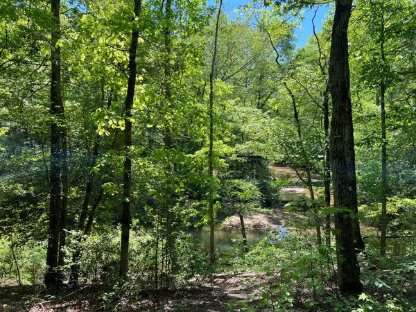
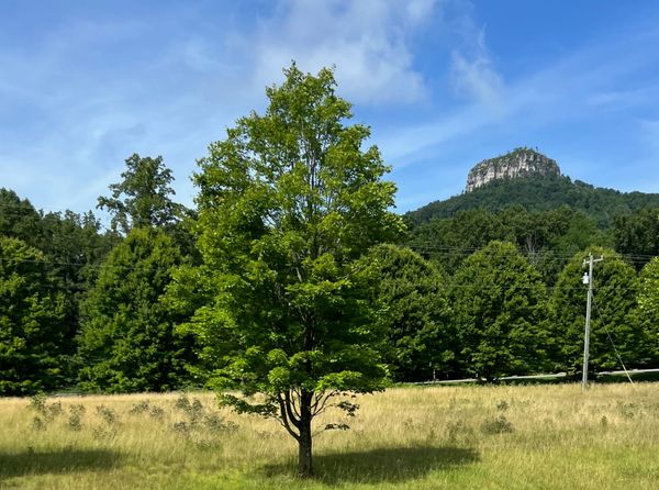
Traveling down Interstate 74 heading south, you can't help but notice this big "knob" of a mountain sticking up out of the green forest of trees and shrubs. It is Pilot Mountain in North Carolina — along with the nearby town of Pilot Mountain and Andy Griffith's own hometown of Mount Airy — that inspired his fictional towns of Mayberry and Mount Pilot. Pilot Mountain is one of North Carolina's most striking natural landmarks — a lone quartzite peak jutting 2,421 feet above sea level, all that remains of the ancient Sauratown Mountains. It was definitely a navigation point for Native Americans, our colonial ancestors, and folks like us traveling through North Carolina. They could easily say that they lived near Pilot Mountain, or, as the Native Americans formerly called it, Jomeokee! Which brings me to my point: how did people back in the colonial days give directions to their homes? This was before Apple and Google maps, AAA and Rand McNally maps, and maps in general, because they were too few or expensive to own. And street names or numbered streets? Only in the bigger towns and cities. Many of our ancestors lived in rural or backcountry areas. It was only during the last century that paved roads and the advent of automobiles came into play, and there are still some rural routes in the South!
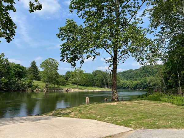
Let's look at a land description from my ancestor, Hugh McCranie, who lived in Cumberland County, in the Royal Province of North Carolina, in the backcountry in 1775.[1] It said:
"Fifty acres of Land in Cumberland County
on the E side of Cape Fear River being Surpluss Land within the lines of his
old survey Beginning at a Spanish or water ?[2]oak tree Creek on the riverbank at the
Mouth of a Deep Gulley being Archd Buies Lower Corner thence as Buies --
line No 55 E 173 poles thence S 35 E 52 poles thence as Hugh McCranies
own line S 55 W 173 poles to the river thence as the river to the beging"
What in the world is this gobbledygook? Well, it is actually the "Metes and Bounds" legal land description used to survey much of the land in the original thirteen colonies. This survey indicates that McCranie's property was roughly a rectangular strip of land bounded by the Cape Fear River to the west, Archibald Buie's property to the north, and Hugh McCranie's property to the south/east. The shape is essentially a long, narrow parallelogram with the river forming the western edge. He was expanding his existing landholdings along the river.
So, how would Hugh McCranie have given directions to his property to someone back then? He might have said, hey, do you know where Archibald Buie lives? Well, I live about 15 minutes north of him. Or, he could have said, from Fayetteville, take the river upstream to the second bend in the river and the fourth creek. Stop when you see a pile of rocks stacked up. You have gone too far if you see Thompson's Ferry. See, not too different from how we give directions today. Except we use Walmart, McDonald's, and Interstates as our landmarks!
- Cumberland County, North Carolina, Land Warrants (1735-1957), [no page number] images, FamilySearch (https://www.familysearch.org/ark:/61903/3:1:3QS7-99WK-C7PK : accessed 17 March 2026), entry for Hugh McCrane/McCranie, Warrant No. 227, IGN 007164744, images 807-810 of 1,412.
- Transcribed by Kim Stracener Zapalac 18 March 2026. Note: ? = Undecipherable letter.
Written by
What's Next?
Moses Austin - Virginia's Forgotten Founding Father
When you think of Virginia, you think of George Washington and Mount Vernon, Thomas Jefferson and Monticello, James Madison and Montpelier, along with other famous Virginians. However, you usually do not think of Moses Austin as one of those other famous Virginians. But he should be considered one of them because there are not many people who helped start a new country, and one that would later become the proud and great State of Texas! Located in New River State Park and Austin Memorial Park i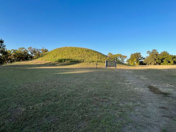
From Childhood Wonder to Ancient Lives — The Mounds That Stay With You
Traveling across the South, you see occasional road signs for Native American Mounds. We try to stop and visit each of them when we come across them. Mounds have been important to me since I was a child. We visited the LSU Campus many times since my father went to LSU, and my parents took us to the football games as soon as we were old enough to walk the long distance from the parking lot to the stadium. Two things on campus were always our favorites: Mike the Tiger and the mounds! At first, we